Introduction to Navigating Berlin
Navigating Berlin can be a rewarding experience, yet it poses specific challenges due to the city’s vast expanse and rich tapestry of neighborhoods. With an area of over 890 square kilometers, the German capital is not only the largest city in the country but also one of the most diverse, encompassing a variety of districts each with its own unique character and culture. From the historical sites of Mitte to the vibrant scenes of Kreuzberg and the tranquil parks of Tiergarten, effectively exploring Berlin requires a good understanding of its layout.


One of the keys to successful navigation lies in selecting an appropriate city map. A reliable map can help visitors efficiently plan their journeys, whether they are walking, cycling, or using the expansive public transportation system that includes trains, trams, and buses. However, without a dependable map, tourists may find themselves lost or overly reliant on mobile applications, which can sometimes falter in areas with poor connectivity.
Moreover, the intricate public transport network, consisting of numerous routes and connections, can be daunting for newcomers. This is where a good city map becomes invaluable, providing not only the location of major landmarks but also detailed routes for navigating public transport. Additionally, navigating through various neighborhoods can be visually rewarding but requires a practical approach to manage time effectively and ensure a fulfilling experience.
In summary, understanding the importance of an accurate city map is crucial for anyone wishing to explore Berlin comprehensively. From experiencing its vibrant communities to managing its extensive transportation options, effective navigation enhances the visitor experience, making it both enjoyable and more manageable.
Types of Maps Available for Berlin
Berlin, Germany, offers a variety of mapping options to assist both residents and visitors in navigating its vibrant urban landscape. Each type of map possesses unique features that may cater to specific needs and preferences. Understanding these different types will help ensure a more effective and enjoyable experience when exploring the city.
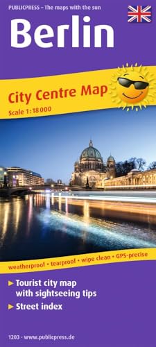
One prevalent option is the physical map, a traditional choice that provides a tactile experience. These maps can often be found at tourist information centers, hotels, and stations throughout the city. Physical maps are particularly beneficial when electronic devices may be less practical, such as in remote areas with no signal or when users prefer a simpler format. They provide a straightforward overview of streets and significant landmarks.
Digital maps, commonly accessed via smartphones and tablets, represent another popular category. Apps like Google Maps and Citymapper offer real-time navigation, estimated travel times, and various transport options. These digital alternatives can also include interactive features such as user-generated content, enabling users to find the latest restaurant reviews or identify points of interest nearby. The convenience of accessing updated information makes digital maps a favorable option for those who enjoy using technology during their travels.
Specialized maps focus on particular aspects of Berlin, catering to niche interests. For example, tourist maps emphasize attractions such as museums, historical sites, and cultural landmarks, making them invaluable for first-time visitors. Public transport maps, available at stations, assist users in understanding the extensive network of buses, trams, and trains, crucial for navigating the city’s transport system efficiently. Additionally, historical maps provide insights into Berlin’s rich past, illustrating significant events and changes throughout the city’s evolution.
Choosing the right type of map largely depends on the user’s preferences, the specific context of their journey, and their navigational skills. A combination of these maps often provides the best approach when exploring all that Berlin has to offer.
Top Recommended Maps for Tourists and Locals
Navigating Berlin, Germany, can be streamlined with the right map options. A variety of maps, both digital and physical, are available to assist tourists and locals alike. Here are some of the top recommended city maps:
1. Google Maps: As one of the most widely used navigation tools globally, Google Maps offers comprehensive coverage of Berlin. This app provides real-time traffic updates, various public transportation options, and user-generated reviews of attractions. Its user-friendly interface makes it suitable for both seasoned travelers and newcomers. Users appreciate the interactive features and frequently updated information.
2. Citymapper: For those specifically relying on public transport, Citymapper is a highly recommended app. It specializes in urban transit systems and includes features like live departure times, route optimizations, and multi-modal transportation options. Users praise its efficiency, making it easier to navigate Berlin’s extensive bus, tram, and subway networks.
3. Offline Maps (MAPS.ME): For travelers concerned about mobile data usage, MAPS.ME provides offline maps that can be downloaded ahead of time. This app allows users to navigate without an internet connection, making it ideal for exploring Berlin’s various neighborhoods and hidden gems. Reviews highlight the reliability and ease of use, making it a favorite among international tourists.
4. Local Tourist Maps: Physical maps are still an excellent option for those interested in a more tactile approach. Available at local tourist information centers, these maps usually feature popular landmarks, public transit routes, and points of interest. Visitors often find these maps beneficial for a quick overview of the city, with some even highlighting cultural events and exhibitions.
Ultimately, choosing the right map depends on personal preferences and the specific needs of the user, be it digital convenience or the tangible feel of a printed map.
Tips for Using Maps Effectively in Berlin
Berlin, a city rich in history and cultural attractions, can be effectively navigated using a variety of maps and mobile applications. To enhance your experience, it is essential to understand how to make the most of these tools while exploring the city.
Firstly, integrating maps with the public transportation system is crucial. Berlin’s extensive network of U-Bahn (subway), S-Bahn (commuter trains), buses, and trams allows for efficient movement across the city. The BVG (Berliner Verkehrsbetriebe) website and mobile app provide updated schedules and route information, making it easy to plan your travels. Familiarize yourself with the different transport zones and ticketing options to avoid any confusion while navigating the network.
Understanding the subway system is fundamental to exploring Berlin. The U-Bahn features various lines, each identified by a letter and color code, connecting key destinations throughout the city. Using a map, you can quickly locate nearby stations and identify the best route to your desired attraction. It is advisable to download offline maps or take screenshots for areas where internet connectivity might be limited.
For those preferring to explore on foot, utilizing maps to optimize walking tours is recommended. Consider highlighting significant attractions, eateries, or parks along your route to maximize your experience. Moreover, applications such as Google Maps, Citymapper, or Komoot can aid in generating custom walking routes tailored to your preferences.
Lastly, downloading relevant apps can further enhance your mapping experience. For example, apps such as Maps.me allow for offline access to detailed city maps. Additionally, incorporating a language translation tool can facilitate understanding local signage, enhancing your overall navigation experience.